


27 June 2010
Report on Flight from Truckee Airport (CA) passing over various mountain ranges and valleys to the Owyhee Wild Horse Herd Management Area (whhma), Rock Creek whhma, and Little Humboldt whhma. (Ill. w/ digital photos taken on flight.)
Elko District, Bureau of Land Management, North Central Nevada, ca. 80 miles NW of Elko. Note: wh is abbreviation for wild horse(s)
Flight realized on Monday, June 21, 2010, Summer solstice.
Dates of report preparation 6/24-25/2010.
Background: Three whhma’s encompass > 482,000 acres of which 336,262 acres are in the Owyhee whhma, 102,638 acres in the Rock Creek whhma and 15,734 acres in the Little Humboldt whhma. Northern portions of the Owyhee whhma occur in the Columbia Plateau physiographic region, but most are in the Great Basin physiographic region. Drought and lack of forage due to fires are being cited by BLM officials as reasons for the drastic reduction of these wild horse herds. BLM plans to gather 1,548 wild horses (the currently estimated total population) and to put back only 399, or which 195 would be PZPed mares with 2-year sterilization effects. This works out to leaving one wild horse per 1,200+ acres – an extreme marginalizing of this species by any standard and very contrary to the “principal” presence mandate of the Wild Horse Act.
Objective: To observe wild horses, their numbers and conditions, note their locations and the ecological condition of their habitat and to observe and note the livestock present in the whhma’s, their numbers and relative proportions vis-à-vis the wild horses, their areas of concentration and ecological effects.
Flight arranged by Lighthawk organization to assist with the gathering of factual information and data concerning the conservation of wild horses on public lands.
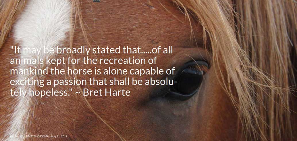
Observer and reporter: Craig C. Downer, Wildlife Ecologist, P.O. Box 456, Minden, NV 89423. ccdowner@yahoo.com. Equipped with D-80 Nikon digital camera with 28-300 zoom lens loaned by wild horse supporter.
Weather: Clear with high, wispy cirrus clouds, conducive to greater flight stability due to less atmospheric convection.
Airport of Origin and Return: Truckee Airport, California, west of Reno.
Time of departure: 8:30 AM. Pass over Reno airport flying over Pah Rah Range, a legal wild horse herd area that has been “zeroed out” by BLM. No wild horses observed here, contrary to statement by Mr. Larry Johnson of the national wh/b advisory board on 6/15/10, Denver meeting, though considerable spring green-up, or grassy vegetation is observed. Our plan is to refuel at the Winnemucca Airport to the east.
10:00 AM. Note vast extension of purple hued Bromus tectorum, a.k.a. Cheat Grass, as plane nears Winnemucca. Velocity: 109 knots. Headwind 10 mph from east.
10:30 AM: Land at Winnemucca Airport. Unfortunately the airport has run out of fuel. We will fly to Battle Mountain Airport to the east to fuel up. We depart at 10:55 AM.
11:12 AM: Flying over portions of Sonoma Range to SE of Winnemucca, I note many cattle (est. 400) mainly grouped around water sources. No wild horses observed. The Sonoma Range Herd Area (NV0223) should have a fair number of protected wild horses, but BLM officials have decided to not manage for them, i.e. to “zero out” in this 150,999-acre herd area (Fiscal Year 2008 USDI Public Lands Statistics). Prevalence of green grass noted, including much purplish cheat grass. Some short aspen groves noted around springs at higher elevations. Enormous open pit mines observed and photographed en route. These have major detrimental effects on water, soil, air, wildlife and human health in the region, including underground water flow disruption and water pollution with mercury, nitrous and sulphuric acid leachates, etc.
11:36 AM: We land at the Battle Mountain Airport for refueling. Fortunately fuel is available here.
12:10 PM: After refueling and eating lunch, we take off from Battle Mountain Airport. We plan to fly to the town of Midas then over portions of the Little Humboldt whhma, Rock Creek whhma then on to Owyhee whhma, reaching the South Fork Owyhee River.
12:43 PM: North of Midas, in the Little Humboldt whhma, seven groups of ca. 12 cattle are seen, for a total of 84. No wild horses observed. Abundant grass here, also large open pit mine. Photos.
12:49 PM: Finally a band is observed consisting of one gray and one sorrel, a male-female pair. Geographical Positioning System (GPS) reading: N 41 deg 21.37 min; W 116 deg 43.6 min. Photos.
12:54 PM: Group of 17 wild horses observed. GPS: N 41 deg 23.19 min; W 116 deg 41.0 min. Appears to be two wh bands in association. Abundant grass & water present. Photos.
12:56 PM: Another band with 9 wh’s including 2 foals encountered and photographed. GPS: N 41 deg 23.3 min; W 116 deg 35.56 min.
12:59 PM: Band of 6 wh’s including one foal spotted & photographed. GPS: N 41 deg 21.36 min; W 116 deg 33.12 min.
1:02 PM. Congregation of several wh bands spotted & photographed. GPS: N 41 deg 22.85 min; W 116 deg 32.3 min. 8 bands with following numbers of wild horses observed: 8, 11, 9, 4, 9, 8, 7, 12. Plane circled around to extensively photograph these. Sum of wh’s in this congregation: 68. Note: This is an upland habitat with plenty of green grass and water sources. This is north of Willow Creek Reservoir near 7,020-foot-high Soldier Cap mountain in the Rock Creek whhma.
1:07 PM: Another band of 7 wh’s seen to SW. Light colored wh’s. Photos. GPS: N 41 deg 25.75 min; W 116 deg 29.2 min. Ca. 400 cattle observed along a stream and meadow near here. GPS. N 41 deg 28.85 min; W 116 deg 28.44 min. Ca. 300 more cattle congregated along a tributary of the above stream. GPS: N 41 deg 32.06 min; W 116 deg 28.1 min.
1:11 PM: Estimated 1,000 cattle observed up to 1:18 PM at GPS: N 41 deg 44.16 min; W 116 deg 25.14 min. Area devoid of wh’s.
1:21 PM: Owyhee Desert – high altiplano (Spanish for high plateau) noted to north.
1:24 PM: Ca. 40 cattle noted by South Fork of Owyhee River. No wh’s. We fly along Owyhee River. GPS: N 41 deg 5.6 min; W 116 deg 34.8 min.
We aim to fly to Capital Peak. Flying along the S. Fork of the Owyhee River, we have not seen any more wild horses, but much evidence of dedication of the land to livestock, e.g. frequent reservoirs, water tanks, fences, grass pasture and hay fields, etc. See photos.
1:26 PM: We continue to note considerable spring green-up of vegetation, though today is the first official day of summer.
1:30 PM: GPS: N 41 deg 55.83 min; W 116 deg 45.7 min. No livestock or wild horses. Several water catchments have been excavated by caterpillar. Incidentally, when they wallow wild horses created such natural catchments for wildlife much less intrusively.
1:34 PM: Another congregation of wild horses spotted in open high plain with trailings. 41 wh’s group together, estimated from 5 bands. Another band of 7 wild horses containing dark grayish blacks amid lighter grays and sorrels. Photos. These bands centered around the following GPS: N 41 deg 56.2 min; W 116 deg 48.2 min.
Another group of 15 wh’s spotted, including grays, roans, sorrels and blacks. This is possibly 2 bands running together. Same general GPS location.
1:38 PM: Observed another nearby congregation including 1 band of 6 wh’s, 1 group of 23 wh’s (possibly 3 separate bands), 1 band of 5 wh’s. I note sparser, drier habitat here and many trails. It appears that these wild horses are being relegated to this area by a system of fences that favor livestock. My earlier entry into the northeastern portion of the Owyhee whhma a couple of months ago revealed extensive fencing and control of water to favor the intensive management of livestock, especially cattle.
1:41 PM: We spot another congregation of 12 wild horse bands. GPS: N 41 deg 57.7 min; W 116 deg 51.3 min. Groupings with the following numbers were encountered: 13 (2 bands) 22 (3 bands), 15 (2 bands), 7, 9, 10, 7, & 9 wild horses. Extensive photos except for last band of 9. Judging from the converging trails from the distinctive individual band home ranges, his summer solstice congregation appear to be trailing to and from a water source. The total number here is 92 wh’s.
1:43 PM: We decide to return to south, to Battle Mountain to refuel, as our small plane requires frequent refueling. A band of 7 wild horses is photographed at GPS: N 41 deg 53.8 min; W 116 deg 52.1 min near an artificial reservoir. Many white ant hills dot the terrain.
Ranch over-flown at GPS: N 41 deg 51.18 min; W 116 deg 52.27 min. No wh’s seen. Remnant snow banks from large winter drifts at ca. 5500 feet elevation. GPS: N 41 deg 47.3 min; W 116 deg 53.18 min. No more wild horses seen.
1:50 PM. Rusty orange water tank spotted. GPS: N 41 deg 43.24 min; W 116 deg 53.38 min. Vegetation is dry and parched, very possibly due to rancher’s monopolizing water from highland drainages. Sparse stunted vegetation. Old pioneer wagon trail seen running E-W, since the old ruts from Conestoga wagons remain in delicate desert ecosystem.
1:55 PM: GPS: N 41 deg 34.7 min; W 116 deg 53.3 min. Neither wild horses nor livestock observed in this dry region. Many ant nests, several water catchments. Low topographical relief in this high altiplano.
2:00 PM: Flying over another ranch. GPS: N 41 deg 29.65 min; W 117 deg 0.3 min. Big meadows and streams. Ranch is monopolizing a large portion of the water for many miles around here for raising livestock. Big reservoir to west along major ranch road is Chimney Reservoir. I observe ca 500 cattle in this area.
2:06 PM: One band of 7 wild horses is observed to the east. GPS: N 41 deg 23.3 min; W 117 deg 01.07 min. Green up of vegetation is noted in high altiplano. Many cattle whose number is estimated at ca. 1,000 profusely dot the landscape, especially around water sources such as streams and springs.
2:10 PM: GPS: N 41 deg 12.87 min; W 117 deg 01.10 min. Ca. 300 cattle present, especially in and around water drainages and also in higher areas in groups of ca 70. No wild horses observed.
2:20 PM: Nearing Battle Mountain Airport. No more wild horses observed.
2:47 PM: Refuel at Battle Mountain Airport. High overcast. Much more grass this year compared with recent years according to the lady attending airport. But are the wild horses getting their fair share of this in their legal herd areas?!
3:06 PM: Take off from Battle Mountain to return via Reno to Truckee Airport in Sierra Nevada mountains, over-flying dry and desolate Humboldt Sink. Very strong jolt to plane cuts pilot’s hand flying over Reno at 4:45 PM. Gravity measured at ca. –1.
5:00 PM. Land at Truckee Airport. 6 ½ hours total flight time.
Tabulations of Totals Observed during Flight over 3 whhma’s: Owyhee, Rock Creek & Little Humboldt.
Wild Horses Observed during Flight
Number of Bands Number of Horses GPS Location
1 2 N 41 deg 21.37 min; W 116 deg 43.6 min
2 17 N 41 deg 23.19 min; W 116 deg 41.0 min
1 9 (w/ 2 foals) N 41 deg 23.3 min; W 116 deg 35.56 min
1 6 (w 1 foal) N 41 deg 21.36 min; W 116 deg 33.12 min
1 8 N 41 deg 22.85 min; W 116 deg 32.3 min
1 11 ditto (Rock Creek whhma congregation of
1 9 ditto 68 wild horses)
1 4 ditto
1 9 ditto
1 8 ditto
1 7 ditto
1 12 ditto
1 7 N 41 deg 25.75 min; W 116 deg 29.2 min
5 41 N 41 deg 56.2 min; W 116 deg 48.2 min
1 7 ditto (First Owyhee whhma congregation of
2 15 ditto 97 wild horses)
1 6 ditto
3 23 ditto
1 5 ditto
2 13 N 41 deg 57.7 min; W 116 deg 51.3 min
3 22 ditto (Second Owyhee whhma congregation
2 15 ditto of 92 wild horses)
1 7 ditto
1 9 ditto
1 10 ditto
1 7 ditto
1 9 ditto
1 7 N 41 deg 53.8 min; W 116 deg 52.1 min
1 7 N 41 deg 23.3 min; W 117 deg 01.07 min
Total Bands Total Wild Horses
- 41 312
Cattle Observed during Flight
Number of Cattle GPS Location
- 84 Little Humboldt whhma. Ca N 41 deg 20 min; W 116 deg 45 m
- 400 N 41 deg 32.06 min; W 116 deg 28.44 min
- 300 N 41 deg 32.06 min; W 116 deg 28.1 min
- 1000 N 41 deg 44.16 min; W 116 deg 25.14 min
- 40 N 41 deg 5.6 min; W 116 deg 34.8 min
- 500 N 41 deg 29.65 min; W 117 deg 00.3 min
- 300 N 41 deg 12.87 min; W 117 deg 01.10 min
- 1000 N 41 deg 23.3 min; W 117 deg 01.07 min
Total Cattle Observed
3,624
Conclusion:
Wild horses were observed to be present in only the very small portion of the three wild horse herd management areas that was over-flown and are certainly not being treated as the principal presences within their legal herd areas as required by the Wild Free Roaming Horses and Burros Act of 1971. The horses I observed were in good condition, although Their numbers are dwarfed by livestock, even within these their legal areas. This is the fault of our public servants, namely BLM officials in charge of protecting and managing this national heritage species at thriving, long-term-viable levels. Reform is urgently needed. This could be accomplished through a revised version of the Restore Our American Mustangs bill (ROAM Senate Bill # 1579). This important bill has already been substantially passed by the House of Representatives but currently is being stopped by powerful vested interests in the Senate. It now languishes in the Senate Committee on Energy and Natural Resources. Pressure is urgently needed to get this moving again before it dies with the ending of the present Congress later this year. The planned roundup of the Owyhee, Rock Creek and Little Humboldt whhma’s needs to be called off; and a more objective assessment of relative numbers and resource allocations needs to be undertaken with the aim of restoring fairer mustang population numbers in this vast and spectacular region. BLM should exercise its authority under Code of Federal Regulations 4710.5 & .6 to cut back on livestock in order to accomplish this.


Cattle at the river (below)


